
By Fred R. LaPoint, Fire Chief & Paramedic, Stronach Township Fire Department | June 2026
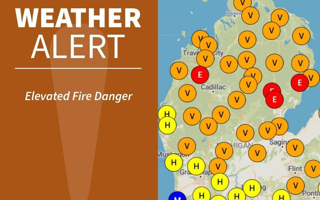
I have spent over 50 years in emergency services. I have seen fire do things that people swore were impossible in their community. And right now, as I write this, the conditions unfolding across Northern Michigan — specifically in and around the Huron-Manistee National Forest — are among the most dangerous I have seen in this region in recent memory.
No rain. No rain forecast for the coming week. Temperatures climbing. Humidity dropping. And on the forest floor, a multi-year accumulation of blowdown debris from winter storms — dead trees, downed limbs, dry pine needles, and tinder-dry duff — waiting for a single ignition source.
This is not a drill. This is not alarmism. This is what fire professionals call a confluence of conditions — and it deserves your full attention.
THE FALSE SENSE OF SECURITY PROBLEM
Let me start with the most dangerous thing working against us right now: the belief that serious wildfires can’t happen in Michigan.
Michigan has the Great Lakes. Michigan is green. Michigan gets rain. Michigan is not California.
All of that is true most of the time. None of it matters when the right conditions converge at the wrong moment.
The 2012 Duck Lake Fire in Michigan’s Upper Peninsula burned over 21,000 acres and destroyed more than 100 structures in a matter of days. The Sleeper Lake Fire in 2012 burned another 16,000 acres nearby, simultaneously. These weren’t California fires. They were Michigan fires. They burned because conditions aligned — dry fuels, low humidity, wind — and ignition occurred.
That same alignment is possible right here, right now, in Manistee County and across the Huron-Manistee National Forest. Anyone who tells you otherwise is not paying attention.
THE FIRE WEATHER EQUATION: WHY A FEW DEGREES CHANGES EVERYTHING
Most people think about wildfire danger in terms of temperature alone. It’s not hot enough to be dangerous — it’s only in the 60s and 70s. What they miss is that wildfire danger isn’t a single variable. It’s the product of multiple factors working together. And when they all move in the wrong direction at the same time, the danger doesn’t add up — it multiplies.
Fine Fuel Moisture: The First Domino
Fine fuels are the small, fast-burning materials that carry fire across the landscape — dry grass, pine needles, leaves, small twigs, the organic duff layer on the forest floor. When these materials dry out, they ignite easily and carry fire rapidly. In normal conditions, moisture in fine fuels acts as a natural brake on fire spread.
After extended days without rain, fine fuel moisture drops to critical levels. When fine fuel moisture falls below 10 percent, fire behavior becomes aggressive and unpredictable. We are rapidly moving toward those conditions right now.
Relative Humidity: The Hidden Variable
Relative humidity is the moisture content of the air. When it drops, fuels dry faster, and fire burns hotter. When it rises overnight, during rain, fuels recover somewhat.
Here is what people miss: even on a mild 68-degree afternoon, relative humidity can drop into the teens or low twenties during peak heating hours. That is critical fire weather. It does not require a heat wave. It requires a clear sky, low-humidity air mass, and afternoon sun doing what afternoon sun does.
Those conditions are entirely consistent with what we are seeing in Northern Michigan right now.
Wind: The Variable That Runs Fires
Temperature and humidity create the conditions for a serious fire. Wind is what turns a serious fire into a catastrophic one.
Wind does three things that matter enormously to fire behavior. First, it dries fuels faster — even moderate wind dramatically accelerates moisture loss from vegetation. Second, it supplies oxygen directly to the fire’s combustion zone, intensifying the burn. Third, and most critically, it drives the fire forward at speeds that can outpace human response and make escape routes disappear.
A fire moving at two to three miles per hour in calm conditions can accelerate to 15 to 20 miles per hour or faster in 20-mph wind with slope and fine fuel loading working together. That is not a fire you chase. That is a fire you run from — if you have time.
The Manistee National Forest landscape — with its rolling terrain, varied canopy, and corridor effects along river drainages — can channel and accelerate wind in ways that a simple weather reading will not predict. I have seen this firsthand working with the Huron-Manistee crews. The wind that registers at a weather station is not always the wind hitting your fire line.
THE FUEL LOADING PROBLEM: YEARS OF ACCUMULATION
In a healthy, actively managed forest, fire behavior is somewhat predictable. Fuel loads stay within manageable ranges through natural fire cycles or prescribed burning. Surface fuels don’t build to dangerous depths. Ladder fuels — the vegetation that carries fire from the ground into the tree canopy — are kept in check.
That is not the forest we have right now.
Multiple years of winter storm activity have deposited blowdown debris across significant portions of the Manistee National Forest. Downed trees. Broken limbs. Uprooted root systems. Large accumulations of coarse woody debris interlocked with smaller fine fuels that have been drying through the spring. This is not just a surface fire risk. This is a complex fuel matrix that can sustain intense fire, slow suppression efforts significantly, and create access problems that hamper both attack and escape.
When crews and equipment cannot move efficiently through a fuel complex, options narrow fast. What might be a manageable fire in accessible terrain becomes a major incident in heavy blowdown.
THE FLOOD/FIRE PARADOX: WHY SPRING FLOODING DOESN’T MAKE THIS SUMMER SAFER
There is one more piece of the false sense of security puzzle that needs to be addressed directly, because it is specific to Northern Michigan this year: the spring flooding.
A lot of people remember those floods. High water. Saturated ground. Rivers out of their banks. The reasonable conclusion a reasonable person draws from that memory is: the forest got soaked, so it’s probably still wet enough that fire isn’t a serious concern.
That conclusion is wrong. And understanding why it is wrong could matter enormously.
Flood Water and Fire-Suppressing Moisture Are Not the Same Thing
Fast-moving flood water does several things to a landscape. It saturates low-lying areas temporarily. It scours stream banks and drainages. It moves across the surface rapidly and runs off. What it does not do effectively is recharge the deep duff layer, the organic soil horizon, or the root zone moisture that keeps fine fuels from drying out during an extended dry period that follows.
The duff layer — the partially decomposed organic material on the forest floor — is what matters most to fire behavior in a forest environment. It holds moisture, it carries fire, and it is the first thing to dry out when warm, dry, breezy conditions arrive. Several weeks of dry weather following a flood event effectively resets fine fuel moisture regardless of what the ground looked like in March. The flooding is a memory. The duff is dry.
Flooding Can Actually Worsen Subsequent Fire Conditions
Flood events can leave a forest more fire-prone than it was before, not less. Moving water picks up and redistributes woody debris, dried organic material, and fine fuels, depositing them in concentrated accumulations along trail corridors, in drainages, and in low-lying areas. Areas that were previously navigable can end up with significantly heavier fuel loads after a flood than before it.
Flood events also destabilize root systems. Trees that survived the winter storms and appeared healthy may have had their root anchoring compromised by saturated soils and erosion during the flooding. These trees are additional future blowdown waiting to happen — adding to the fuel matrix already described above.
The Terrain Has Changed — And Most People Don’t Know It
This is the part that concerns me as much as anything from an operational and public safety standpoint. The spring flooding caused significant damage to trail systems, forest roads, and two-tracks throughout Northern Michigan. Washed-out sections. Undermined shoulders. Collapsed culverts. Scoured stream crossings that are now deeper and wider than they appear. Blowdown across trail corridors from trees toppled by saturated and eroded soils.
Anyone who hiked, rode, or drove a forest road before the floods has an outdated mental map of that terrain. What looked accessible may not be. What looked stable may not be. Trail systems that were reliably navigable are now, in some sections, treacherous. This has two serious consequences under elevated fire conditions.
First, for recreationists: compromised terrain in a fire environment eliminates escape route options that you may be counting on without knowing they no longer exist. A washed-out trail is not just an inconvenience. Under fire conditions, with smoke and wind and adrenaline, a trail that ends at an eroded gully is a trap.
Second, for suppression operations: access routes that appear on maps and pre-plans may not be passable for apparatus or equipment. Tenders cannot get where they cannot drive. Crew movement slows through compromised terrain. The response geometry that fire managers have planned around may not match what crews find on the ground. This is a real operational constraint that agencies are aware of and working around — but it is a constraint nonetheless, and it reinforces why early detection and early reporting is more critical than ever this season.
The floods gave us water we could see. What we have right now is a dry forest floor we can’t see from the road, sitting on top of terrain that has been quietly compromised in ways most people haven’t reckoned with. That combination deserves respect.
THE HUMAN IGNITION FACTOR
Lightning starts fires. But in Michigan, and in the National Forest recreational corridors, the far more common ignition source is human activity. And the late spring and early summer recreational season means ignition opportunities are at their peak right now.
Consider what is happening in and around the Manistee National Forest right now: camping, hiking, mountain biking, horseback riding, ATV use on forest trails, and dispersed recreation in areas that see minimal oversight. Any one of these activities carries ignition potential under current conditions.
Campfire Risk
An unattended campfire ring that seems cold can retain enough heat in the ash bed to reignite hours later if the wind picks up. Fine fuel moisture at critically low levels means that a few embers drifting from an improperly extinguished fire can start a ground fire before anyone realizes it is happening. The rule — cold to the touch means truly extinguished — is not optional. It is the difference between a contained fire ring and a forest fire.
ATV and Off-Road Vehicle Risk
This one often surprises people. Off-road vehicles and ATVs operating in dry conditions through heavy blowdown debris carry real ignition risk. Hot catalytic converters dragging or sitting close to dry debris. Sparks from metal-on-rock contact. Overheated engine components in areas with poor airflow. These are documented ignition sources for wildland fires. Operators in the Manistee National Forest right now need to be aware of where they are parking, where their machines are stopping, and what is underneath them.
The Simple Spark
A cigarette from a vehicle window on M-55 or any of the forest access roads. A glass bottle focusing sunlight on dry duff. A power tool in a dry clearing. Under normal conditions, these carry minimal risk. Under current conditions, any of them is a potential ignition source. That is not an exaggeration. That is fire physics.
WHAT GOOD PREPAREDNESS LOOKS LIKE RIGHT NOW
I want to be direct here. The agencies with primary responsibility for fire management in the Huron-Manistee — the United States Forest Service, Huron-Manistee National Forest crews, and the Michigan Department of Natural Resources Wildfire operations division— are professional, well-trained, and well-coordinated. Stronach Township Fire Department works closely with both. We have mutual aid relationships. We train together. When a fire starts, the response is there.
But no combination of agency resources can compensate for a delayed report, a preventable ignition, or a public that is not paying attention. The early detection window is everything in wildland fire. Every minute between ignition and report, and between report and first resource arrival, is minutes of fire growth that cannot be recovered.
Here is what every person in Manistee County and across Northern Michigan can do right now:
If You See Smoke, Call Immediately
Do not assume it is a campfire. Do not assume someone else has already called. Call 911 immediately. Describe what you see: color of smoke (white, gray, black), location as specifically as you can (road name, landmark, GPS coordinates if you have them), and direction the smoke appears to be moving. Early report means early attack. Early attack means better outcomes. This is the single most impactful thing a member of the public can do during elevated fire conditions.
Campfire Decisions: When in Doubt, Don’t
Check current fire restrictions before you build any fire in or near the National Forest. Even where campfires are technically permitted, ask yourself whether conditions warrant it. If you do have a campfire, extinguish it completely — cold to the touch — before you sleep or leave. Drown it. Stir the ash. Drown it again. These are not suggestions. These are the habits that prevent headlines.
Know What You Are Walking Into
If you are heading into the Manistee National Forest right now — hiking, camping, riding, any recreational activity — understand that conditions are elevated. Know two ways out of wherever you are. Know your location at all times. If fire behavior changes rapidly and you need to call for help, the dispatcher needs to know where you are.
Watch Your Equipment
If you are operating any motorized equipment in the forest — ATVs, chainsaws, tractors, any off-road vehicle — be aware of where it stops, what is underneath it, and whether it has the potential to generate sparks or heat in contact with dry vegetation. Give your equipment time to cool before parking in or near dry fuel.
Spread the Word, Not the Fire
Tell people in your circle what you are reading here. Share it with your camping group. Talk to your kids about it before they head into the woods. The reach of official fire weather advisories is limited. The reach of personal communication is not. The National Weather Service Gaylord fire weather page is at weather.gov/apx/fire_Huron and is updated regularly, and is the official source for Huron-Manistee fire weather planning forecasts.
THE BOTTOM LINE
FROM A CHIEF WHO HAS SEEN IT: The conditions in Northern Michigan right now are not routine. They are not cause for panic — but they are absolutely cause for heightened awareness, sound judgment, and collective vigilance. The agencies and departments working these forests are ready. What they need from you is prevention and early detection. Do your part. Call early. Burn responsibly. Pay attention.
Wildfire does not respect county lines, state borders, or the conventional wisdom that says it can’t happen here. It happens where conditions allow. Conditions are allowing right now.
Stay sharp out there.
Fred R. LaPoint
Fire Chief & Paramedic, Stronach Township Fire Department
U.S. Coast Guard Veteran (TT2, Vietnam Era) • Team Rubicon Greyshirt •
Behind The Alarm is published on Substack. Subscribe for fire safety and emergency services content from the field.
This article first appeared in Behind The Alarm, the newsletter of Fred R. LaPoint, Fire Chief Paramedic of the Stronach Township Fire Department, on June 2, 2026. Read the original.